Sunday, July 15, 2012

Quick and Close to Home

Weekends are the only time we can hike, but they're usually also some of the only times we can catch up with friends and work on projects. John and I had a busy Sunday last weekend, but wanted to hit the trail at least a little, so we headed to San Jose's Alum Rock Park, about a 20 minute drive from where we live.

We set out to go up the trail we usually take--the Boccardo Loop Trail--because it's a trail we can usually do in about 2 1/2 hours and it has some good steep hills. However, it was a hot day and Boccardo Loop has very little shade. Also, it's one of the trails where we've seen the most rattlesnakes, and the warm season is when we've seen them the most (in fact, Alum Rock seems to have a pretty high concentration of snakes of all kinds in general. It's actually kind of amazing I'm willing to set foot in the park! I wish snakes no harm, but I'm not eager to hang out with them.)

It wasn't the hottest day we've had this summer, but warm enough that about two hills into our hike, we decided to head towards the shadier side of the park. The trails on that side don't offer as much of a climb, but there's much more protection from the sun.


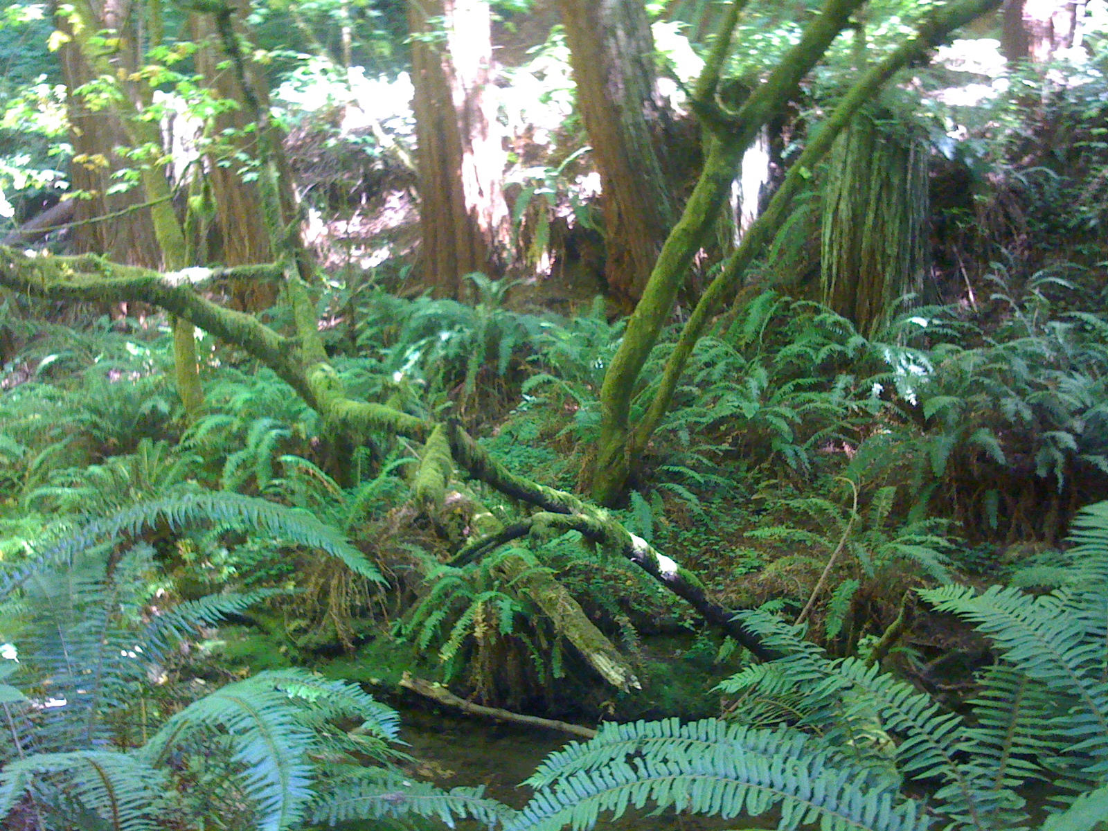
Alum Rock Park is located in a long canyon, along a creek. On our hike into the park, we took the North Rim trail, which follows one edge of the canyon and then dropped down into the canyon, which is always shady and beautiful. Alum Rock Park is a favorite spot for family get-togethers (spring through fall, it's usually packed on weekend holidays like Easter and Mother's Day). The park has wide lawns and many picnic grounds. Although once or twice we've grabbed some sandwiches and had a quick bite at a picnic table there before hitting the trail, we'll have to invite a bunch of friends and make a day of it some time.

Seemingly at odds with being such a picnic hotspot, the park is apparently home to a number of mineral springs that smell terrible--like sulfur. A century ago, people headed out to the park to "take the waters" and enjoy whatever health benefits the mineral springs were thought to have had. I guess the thinking was, if it smelled so bad, it had to be good for you? Anyway, around the park, there are still a number of little stone huts, some with built-in benches, where people would sit to breathe in the stinky vapor of the water. There are also some cool old stone bridges, and my favorite, this very grand set of steps for a bridge that's now clearly very different than the one they were built for.


This bridge was part of our walk across the canyon floor, and then we headed back up the other side of the canyon on the Switchback Trail. No false advertising here--the Switchback Trail has plenty of long switchbacks, winding up the hillside to a ridge where you can pick up the South Rim Trail, which you can take directly back down into the canyon, or follow it down another set of switchbacks on other side of the hill and then back into the canyon.


The top of the Switchback Trail offers some nice views that look farther back into the hills, as well as some nice views of the valley, when it's not too hazy.


The last time we took the Switchback Trail, we continued down the switchback side of South Rim Trail to get back to the canyon floor, but the trail lacks shade and it was pretty narrow, with a lot of weeds and grass growing into the path--the kind that makes you feel a little paranoid about ticks. It wasn't something we felt like dealing with that day, so we turned around and went back the way we came.


There's a bench on the ridge at the top of the Switchback Trail that faces the view of the valley. John hits the water bottle and enjoys the view.


Tuesday, July 10, 2012

Backrests and Drink Holders

While we were in the North Bay, we went canoeing on the Russian River. On the last day of our long weekend we headed back into Guerneville, where it seemed most of the canoe rental companies were located. After googling various canoe rental companies (there are a bunch in town), we chose King's Sport and Tackle, in no small part because a Yelp review recommended their canoes for their cushiness--backrests and drink holders!--as well as the company for having good service. Sure, canoeing is outdoorsy, but this was not intended to be one of our more athletic ventures. Relaxing in a boat (maybe or maybe not with a beer) on a sunny summer day on a mostly lazy river was just what John and I wanted.

So we rented a canoe from King's, picked up the canoe at Johnson's Beach in Guerneville and headed off down the Russian River for a four-mile paddle to the next town down the river, Monte Rio.

We left from Johnson's Beach in Guerneville


About an hour into our trip, we encountered a summer dam, and we had to portage the canoe from one side to the other. It was only about 200 feet, but let's just say that canoes are heavy. And also, they tip easy. Trying to get the canoe back in the water almost resulted in John and I going into the water. We were lucky a kind stranger was around to keep us from tipping. This photo of the dam and the canoe (really!) looks like the weather was at 500 percent humidity because it was shot from inside a ziploc bag. They're great for keeping cellphones dry, but don't, it turns out, make a great filter for cameraphones.


Instagram? No. Ziploc


The river was fairly busy with lots of other people in canoes or kayaks, as well as swimmers, so when we wanted to stop for lunch, we had to hunt for a while to find an unpopulated part of shoreline that wasn't also a vacation home's private beach. The whole trip was a beautiful paddle, so this was not much of a hardship.


For lunch, before we hit the river, we picked up sandwiches and drinks at Big Bottom Market in Guerneville--it was as tasty as I thought I would be. We ate lunch on a big sand bar at a bend in the river. Then we paddled the rest of the way to Monte Rio, where a shuttle from the canoe rental company picked us up and brought us back to Guerneville.


And those drink-holders did come in handy.

Sunday, July 1, 2012

'Steep Trail?' Yep.


John and I are staying in the North Bay, taking a long weekend to celebrate our anniversary. So for a hike, we headed to Armstrong Redwoods State Natural Preserve that's about 20-25 minutes from where we're staying in Forestville. The park is known, as you might guess, for its beautiful redwood trees.
We got a late start, even for us, and didn't hit the trail until about 3pm. Armstrong Redwoods is near Guerneville, which seems to live up to its reputation as a summertime getaway because we encountered a long line of traffic in the town, but it didn't actually take too long to get through town and on our way.

Given how bustling Guerneville was, it wasn't a surprise that Armstrong Redwoods also had a lot of visitors. The park entrance was busy and the road leading up to the reserve was lined with cars.
From behind the Visitor Center, we took the East Ridge Trail, up about 1200 feet over 2.7 miles through mostly open forest. The trailhead had "Steep Trail" signs, but it's all relative and I never take those too seriously until I find myself struggling up a steep hill or two. (I mean, Mission Peak doesn't have such signs--though "Sun-Baked Vertical Slog" signs might be more appropriate there), but I did in fact find myself struggling up a number of steep hills on the East Ridge Trail, so, OK, those signs were pretty accurate.

 The trail was a bit slippery here and there with dusty, gravelly patches, but it wound up the hillsides through open forests of bay trees. There was a lot of filtered sunlight, but it was mostly shaded and a beautiful climb.

We were grateful for the shade because the weather was hot, and almost a little humid. Hiking in the heat--not hitting the trail till mid-afternoon is a mistake we often repeat--slowed us down, and it took some effort to get to the top.  Once we reached the end of the East Ridge Trail, the views were worth it.

At the end of East Ridge, rather than head back the way we came, we picked up the Pool Ridge Trail for our descent, coming back down roughly another 2.5 miles. This trail was also mostly shaded as well--more bay trees and some evergreens. We met a good number of other hikers along both the East Ridge and Pool Ridge trails, which wasn't a shock, since the park entrance had been so crowded, but neither trail was uncomfortably busy (like Yosemite in the summer often is, for instance). A little spur called the Loop Trail appears to have shaved a little distance off our descent--it's up for debate, and the map was a bit confusing, but no matter, because  it did offer us another nice view.


At lower elevations, the trail wandered through shaded canyons, along mostly dry creekbeds, and final 1/2 mile or so became more of a stroll through a flat, dense redwood forest.

Despite being a bit sweaty and dirty, we stopped in Guerneville for dinner, and had some tasty food at the Big Bottom Market, which serves what I'd call comfort food, but not in the unhealthy or heavy way that implies. Big Bottom also has a deli with sandwiches and salads, and a shop area that sells local wines, and goodies like high-end olives, cheeses and chocolates. Looks like a good place to stock up for a picnic.

Sunday, June 24, 2012

Friends and 'Big-Ass Trees'

Our friends Tiffany and Ruth, visiting the Bay Area from L.A., wanted to do a challenging hike, and preferably one not in the hot, open chaparral terrain that they tell us they encounter on most of their Southern California hikes. Tiffany and Ruth asked for "big-ass trees." We were sure we had the answer.
The plan: the Dipsea Trail In fact, most, but not all of a Double Dipsea, which goes 7 miles from Mill Valley over Mt. Tamalpais to Stinson Beach and back those 7 miles again. SInce none of us were prepared to do the full 14-mile round trip, we decided to skip the 170-something stairs that make for a distinctive if slightly discouraging start of the trail in Mill Valley and hit the trail a few miles down the road in Muir Woods, making it more of a 9 or 10-mile trek. Also, we hear tell that there's a pub in Muir Woods. Never found it yet, but maybe this would be the day that we finish our hike with a beer in a secluded forest tavern.

But ... the Double Dipsea race was taking place on the only day our friends would be in town. Not wanting to dodge runners--and worse, force them to dodge us--we needed to hike somewhere else, that offered at least a moderately challenging trail with redwood forest, that was also easily accessed from the South Bay and San Francisco, where Tiffany and Ruth were staying.

An excellent Plan B came, as many of our best hiking plans do, from Bay Area Hiker: Purisima Creek Redwoods Open Space Preserve near Half Moon Bay
It was a 7-mile loop hike that definitely delivered on the redwood forest--just what our friends were hoping for--and, as requested, also a few "big-ass trees." 


The spot was more popular than we expected. When we arrived mid-morning, we found that the Sierra Club had organized a group hike, and that meant that the small parking lot was full, and the road had cars parked along the side for about 1/4 mile beyond the preserve. But despite the number of cars and the many hikers we saw gathering at the trailhead we really only encountered maybe a dozen other hikers on the entire journey.

We hiked a loop comprised of the Purisima Creek Trail to the Craig Britton Trail to the Harkins Ridge Trail. This was a nice moderate hike with a lot of cool forested areas that followed creeks, as well as some open, more scrubby areas that offered some nice views of the ocean.


Ruth's desire to see a banana slug was fulfilled about 40 times over, when the forested areas of the trail proved to have such a large banana slug population that whoever was in the lead of our group ended up calling out "slug!" warnings to let us know a slug was in the path. Not every slug we saw had survived the day, but we were pretty careful to avoid creating any casualties.

Had we started at the Harkins Ridge Trail--also accessible at the Higgins Canyon Road trailhead, we would have had a more challenging trip: Harkins Ridge is fairly steep and rocky, and also much less shaded. The Craig Britton trail, which connects Purisima Creek trail to Harkins Ridge, is a little narrow and overgrown in spots, so we checked for ticks several times. The Purisima Creek trail is fairly level and wide. That would make for a beautiful short walk in the forest just on its own.


Before our hike, we stopped a few miles outside of Half Moon Bay for breakfast at Blue Sky Farm. It's a cute cafe/nursery and they have some spicy Mexican hot chocolate!

Our reward for finishing the hike? Chai at Raman's Coffee and Chai. On a previous visit to Half Moon Bay, our friend Rik, who was also hiking with us, had found Raman's, which serves what he thought might be the best chai he'd ever had. It was definitely delicious. I especially loved the ground cardamom on top.